British Columbia
Central Coast
Briggs Inlet | Way Back Wednesday
Wednesday, March 29, 2017TheCambrians
It’s Way Back Wednesday, an opportunity to dig through the
files and pull out an old blog post to
shed some new light on it. Over the years, I’ve written several posts about
anchorages we’ve stayed in, including first-hand anchoring information (i.e.
holding, protection, GPS coordinates), historical information and things to do.
To date, I’ve done 26 of these (they can all be found on our Destinations
page) and they’re some of my favourite posts. For the next six months, I’ll be
highlighting one every Wednesday (from south to north) and adding a few new
ones in where I can. This week, it’s a return to Briggs Inlet in British Columbia’s Central Coast.
The
Central Coast is a popular place during the height of the
summer, not by the same
standards as Desolation Sound where sharing an anchorage with dozens of other
boats is the norm. But in a “Damn! There’s already another boat anchored here”
kind of way. And the closer you are to Shearwater, the busier it gets. But
Briggs Inlet, north of Return Channel, can be a really nice break from all of that.
It’s
all about location and Briggs Inlet has the misfortune of being sandwiched
between Roscoe Inlet (one of the most striking fjords along the Central Coast)
and Spiller Inlet (home to Ellerslie Lagoon and Falls), so it’s understandable
that it gets overlooked by most boats.
But it shouldn’t. The scenery may not compare to that of its neighbours,
but it’s beautiful in its own right: It’s
narrow and intimate with rolling, tree-covered mountains and steep granite
walls that embrace you, making you feel right at home.
But
it does come with a couple of obstacles, starting with the First Narrows. About 2.5 miles from the entrance, Briggs Inlet takes a turn
westward and tapers down to 80 metres (262 feet), causing a large section of
turbulent water. Somehow David and I both missed this piece of information when
planning our route and hit the narrows on a rising tide when it was running 3
knots. The flow was laminar but the water was active for a half-mile or so and
included upwellings and small whirlpools that did a good job of kicking Cambria around.
Travelling with the current, it wasn’t an issue but we made sure to time our
arrival the following day closer to slack tide.
Just
north of the First Narrows lies Emily Bay,
a beautiful and quiet anchorage with good holding and protection. But it also
offers something else that’s pretty rare in that part of the world – a short
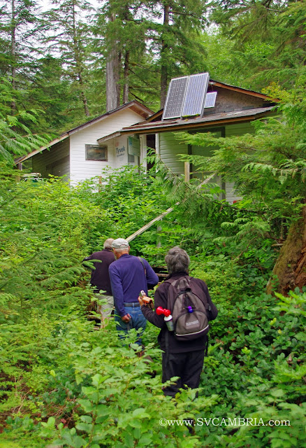
hike. A primitive trail that passes through a fish hatchery run by the Heiltsuk
Nation out of Bella Bella is located at the head of the bay. Some changes have
taken place over the last few years and the conditions that were described in
the Douglass cruising guide, “Exploring the North Coast of Bristish Columbia”
have been improved. It’s still on the undeveloped side and difficult to follow
at times, but new boardwalks and bridges have been installed and access is more
straightforward. There’s a slight rise in elevation (about 30 metres or 100
feet) over the span of a quarter mile or so and the trail leads to the head of Emily Lake.
North
of Emily Bay, the inlet continues to Briggs Lagoon and the second narrows. We
weren’t interested in taking Cambria through a poorly charted entrance that Douglass
describes as a set of rapids and tight, so that ended our exploration of Briggs
Inlet . . . by boat. We did, however, make it to the lagoon from a trail located
at the head of Boukind Bay
(Roscoe Inlet). It wasn’t the most adventurous way to see the rest of Briggs
Inlet, but it was the easiest and didn’t require waiting for high water slack
to get in and out. It was also another opportunity to get off the boat and
stretch our legs. And that, along with everything else, is what made Briggs
Inlet worth visiting.
Waypoints of Interest:
First Narrows: 52°21.587 N, 128°00.448 W
Emily Bay: 52°23.527 N, 127°59.979 W (Approach)
52°23.519 N, 128°00.692 W (Anchorage)
Boukind Bay: 52°26.733 N, 127°56.203 W (Approach)
52°27.786 N, 127°56.257 W (Anchorage)
Things to Do:
Take
a hike to Emily Bay
(Briggs Inlet).
Take
a hike to Briggs Lagoon (Roscoe Inlet).
Disclaimer: This blog article is not to be
used for navigation. It is solely an account of our personal experience and
anchor locations in Briggs Inlet during settled weather conditions. What worked
for us at one particular time is no guarantee or indication that it will work
for others. There are no services in the immediate area and any boat that
enters should be self-sufficient.


1 comments
I wonder if we will get this far up before we get going for Mexico. I'm so torn because I would love to visit these places you've written about, but I don't want to spend next winter here! Choices choices. That looks like a good place for bear watching.
ReplyDelete